
The spring solstice has come once again which only means one thing… It’s HIKING SEASON. There’s very rarely a time I turn down hiking— unless it’s raining, hailing, freezing, lightning, earthquaking, you get the point— and it’s one of the things I love doing most in my free time.
This post is the second round of my Washington Hiking Guide, which if you haven’t checked out, you should. Upping the elevation, the views, and the fun— Washington, you and your hikes keep getting better. If you haven’t done any of these, strap on your boots and get to hiking!
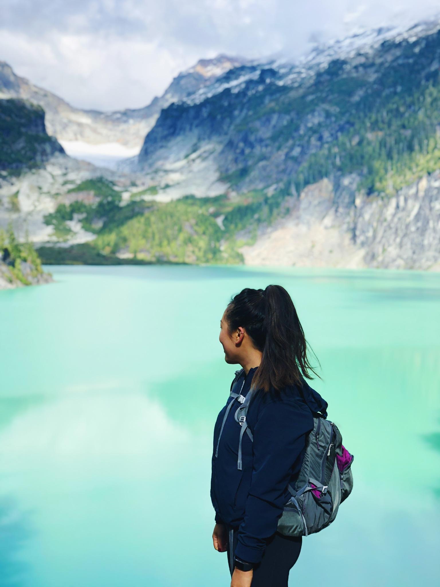
Distance: 7.5 mi RT
Elevation Gain: 3300 ft.
Location: North Cascades
Company: Emma
Notes: NEVER HAVE I EVER SEEN SOMETHING SO BLUE/TURQUOISE/ROBIN-EGG BLUE. When I picked up Emma at 7:00 in the morning, we had absolutely no idea where we were going or what hike we were doing. By 7:02, we decided on Blanca Lake. Thus the start of a b-e-a-utiful hike and friendship. (Side note: I didn’t know much about Emma until the day before when out of my loneliness I asked her if she wanted to go hiking and now that we have found out we are kindred spirits, she has become my latest and greatest adventure buddy!).
Blanca Lake is an extremely popular hike and for good reason. The trail is very well maintained and the hike itself I would say is moderate, definitely drains the legs a little but worth it. After the first three miles of close forest, you hit the ridgeline, descend past Virgin Lake and make your way through an abundance of huckleberry bushes. The last mile or so there is a lot of downhill walking, which is great for when you are tired from going uphill, but something to keep in mind when you have to head back the other way. Nonetheless, the result is absolutely breathtaking when you make it to the final destination. (Second side note- not sure this is actually 7.5 mi RT, it felt much longer, but you can dwell on that at the end of your hike.)
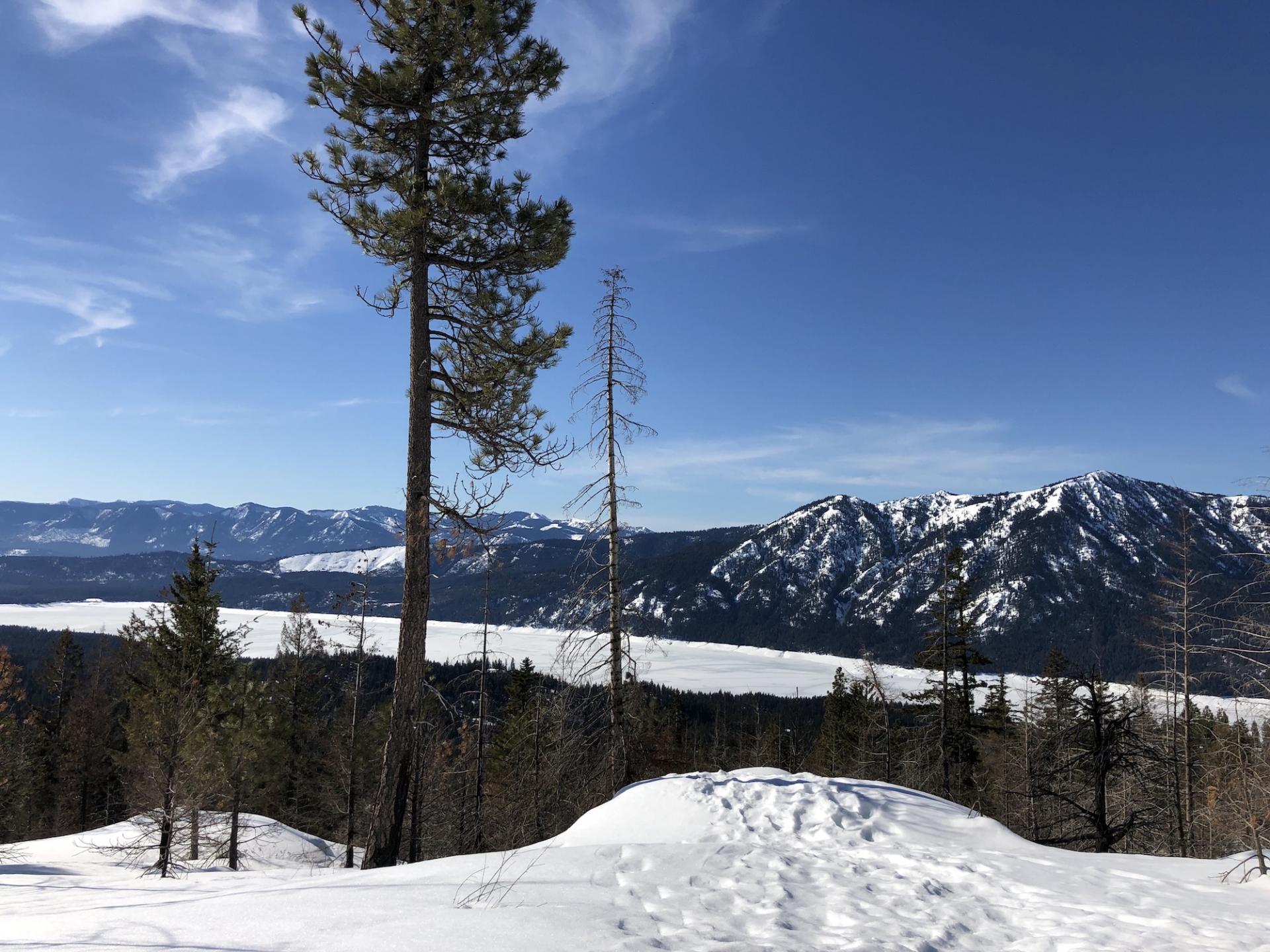
Distance: 7 mi. RT
Elevation Gain: 2600 ft.
Location: Snoqualmie
Company: Emma
Notes: The most recent hike I went on was also my first time snowshoeing! I found out about this hike from Nudge Text and like the post says, you’re gonna want to make it to the top. We rented our snowshoes from REI which you can reserve ahead of time (for an additional fee), but they have a couple hundred in stock so you have a pretty good chance of getting them day of/before. The drive out to the trailhead was surprisingly short (only 1.5 hours) and the notes to find the trailhead easy to find. The trail was very open and wide, with semi-frozen packed snow, but the sun was beating down which made for the perfect snowshoeing day. A little over an hour into the hike we came to the ridgeline that made a great space to plop down for lunch and bask in the crisp, pure white field.
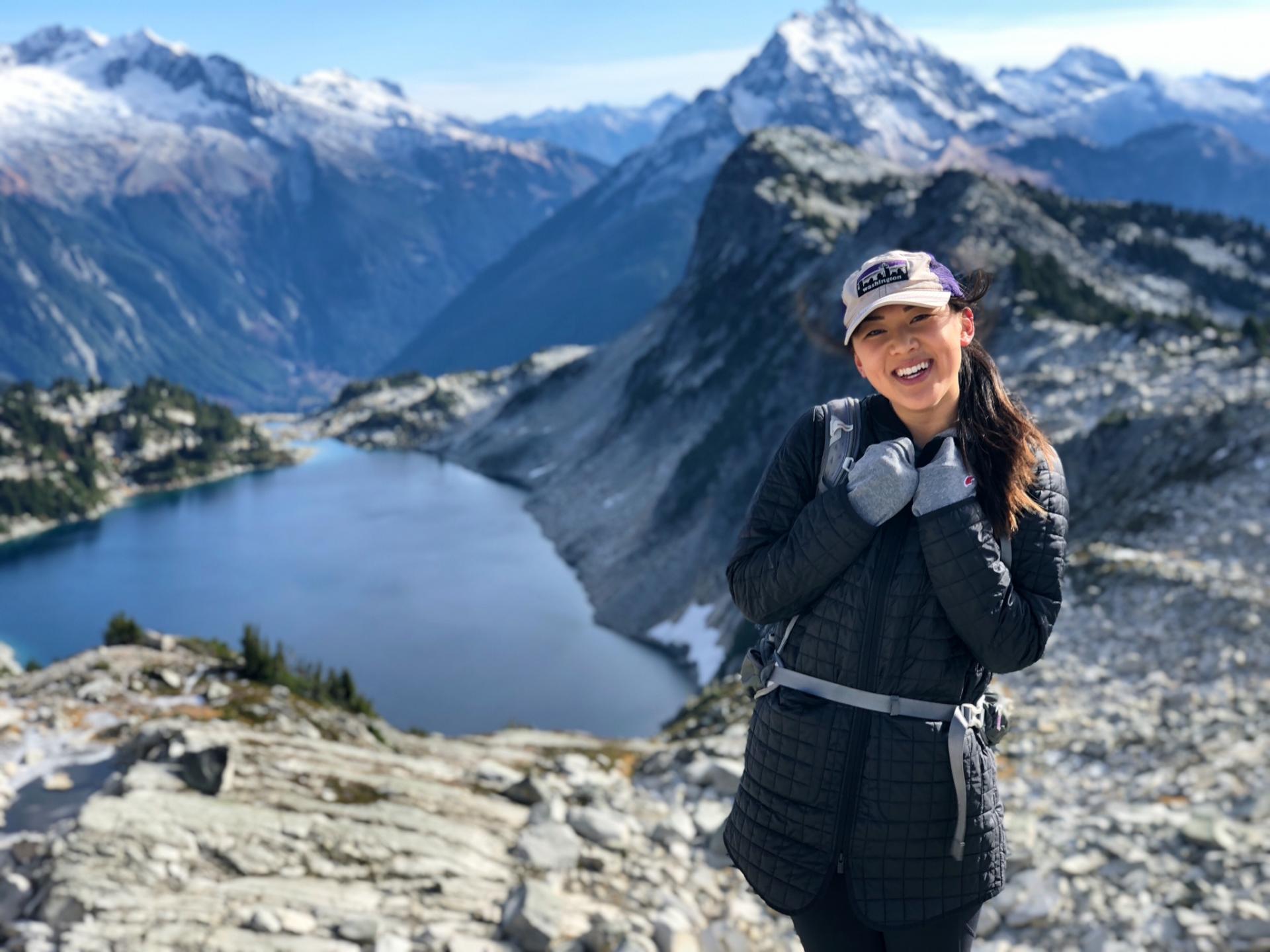
Distance: 8 mi RT
Elevation Gain: 3300 ft.
Location: North Cascades
Company: Emma (seeing a theme here?)
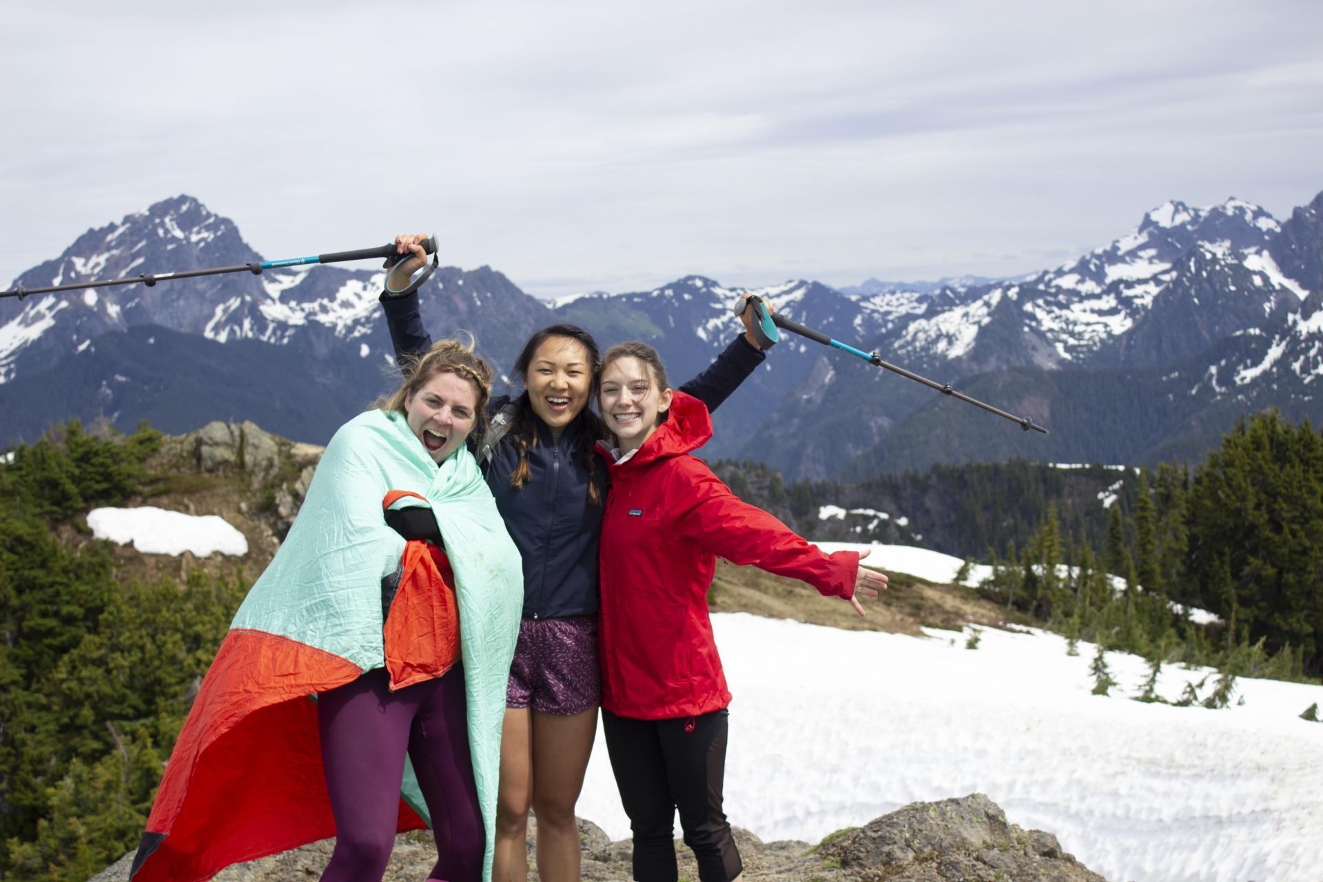
Notes: The hike- G O R G E O U S. The summit- W I N D Y A F. Emma picked this one and I had never heard of it up until we started off on the trailhead. So many different terrains and views in one journey, the contrast between the start and the end are of extreme opposites. The trail starts with dense forest, which after a mile opens below soaring cliffs colored with crimson and burnt sienna of deep creek drainage. The terrain then changes to blueberry bushes and sprinkles of rocks which reminded me of hiking the hillsides of Greenland. It changes again to a vast field and then again through a valley of granite to your final destination. I’m kind of a stickler for not repeating hikes because there are so many to do, but this one I would make an exception for because it was that INCREDIBLE. There is also a lookout tower further up, but we chose to eat our lunch in plain sight of the view before us (and shielded from the 40+mph winds that graced our arrival at the top).
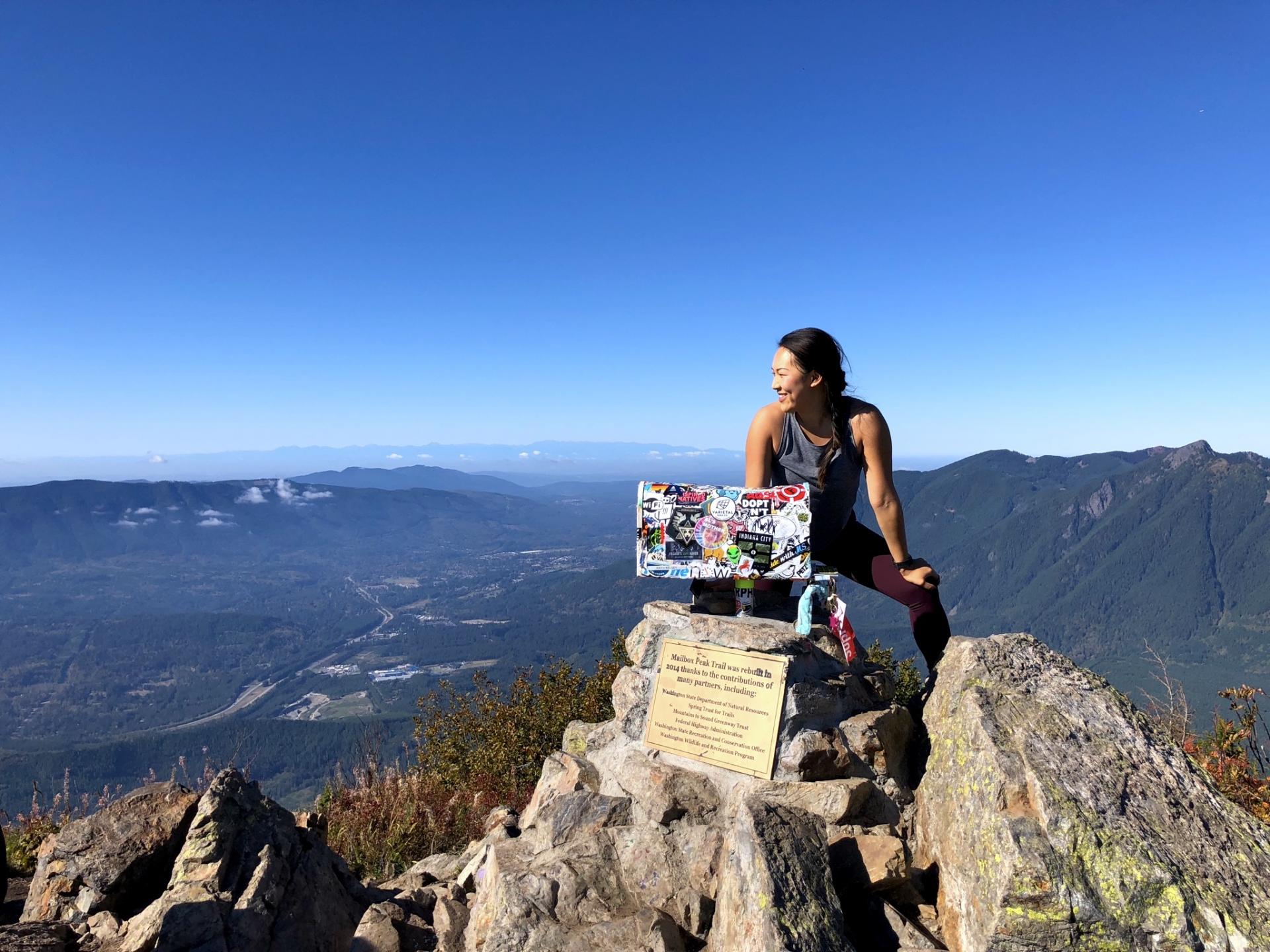
Distance: 9.4 mi RT
Elevation Gain: 4000 ft.
Location: Snoqualmie
Company: Chelsea
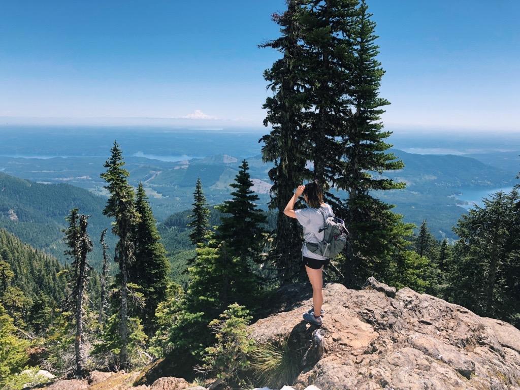
Notes: This is another Seattle classic on most everyone’s hiking list. Despite this consistently being mentioned as a “super hard hike” and regarded with some hesitation, I was expecting it to be much harder than it was. When you start, be sure to take the correct trailhead, as there is an old and a new trailhead (we took the new). The last quarter of the trail is basically half-hiking, half- climbing with a very step incline, but the first three quarters are actually quite enjoyable. Once at the top you get a panoramic view of the Cascades, including Rattlesnake Ledge, another iconic Seattle hike, that from this viewpoint looks like an ant hill in comparison. There are lots of spots to sit and enjoy lunch so pack a yummy one (or take it to the next level like a nearby hiker that hauled his own grill to the top to make fresh blueberry pancakes.) If you want to be nostalgic, pack something fun— but light!— like a letter, candy, sticker or souvenir to leave in the mailbox to signify your victory to the top.
Distance: 8.2 mi RT
Elevation Gain: 3950 ft.
Location: North Cascades
Company: Amanda, Kaitlyn, Jackie
Notes: This was an absolute Dickerman. I don’t complain often about hikes, and I still won’t. But I am pretty sure this is one of the hardest hikes I have done, much more so than Mailbox Peak. We hiked this beaut on the fourth of July and even in the middle of summer, there was an abundance of snow at the top. I don’t remember much of the first half of the hike, maybe because I intentionally blacked out, but there were a lot of switchbacks. The second half is interspersed with trekking through big open fields, but once you hit the summit ridge and the mountains wrap you in a congratulatory hug, you’ll realize all your hard work was worth it. From the top of Mt. Dickerman you can see almost EVERY MAJOR MOUNTAIN in the northern Cascade mountain loop; Three Fingers, Whitehorse, White Chuck, Pugh, Glacier Peak, Baker, Shuksan, Pilchuck, and Rainier to name a few. On the way down it can be a little hard on the knees as it is steep so be careful, or do like I did and make your portable blanket a makeshift sled.
Perfectly quoted by the WTA “With the possible exception of Hidden Lake Lookout, this is the finest summit view around–a rare chance to get so close to so many other summits at the same time. Mount Dickerman may have asked a lot of you to get here, but it will have more than held up its end of the bargain.”
Distance: 6.2 mi RT
Elevation Gain: 3300 ft.
Location: Olympics
Company: Keith
Notes: My first hike in the Olympics! I have been wanting to hike the Olympics more and sometimes it feels like they are SO much farther away than the Cascades, but Mt. Ellinor sits right on the eastern edge of the Olympics which is the perfect distance to go and come back in a day. We hiked this around May so the majority of the hike was snow-free, but the top was still heavily covered in snow. At the top you’ll be met with one of two options, veering off to the right to rest on rocks overlooking the east Olympics or strapping on some spikes, pulling out picks, and joining the many others that are preparing to make it to the summit.
Distance: 5.4 mi RT
Elevation Gain: 1350 ft.
Location: North Cascades
Company: Chelsea
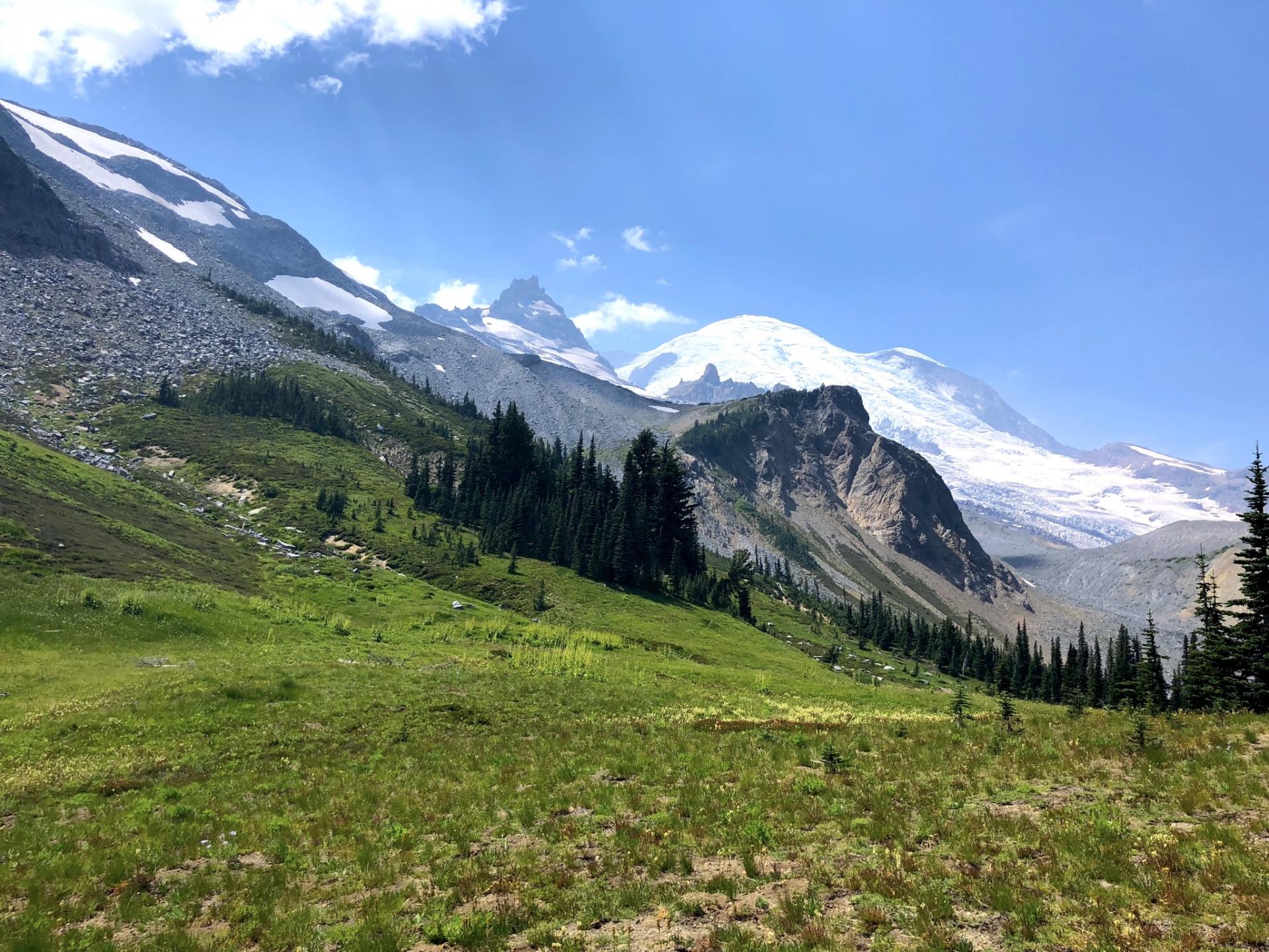
Notes: You can never go wrong with Mt. Rainier: the apple of Washington’s eye. Add this hike to your list of over 260 miles of hiking that Mt. Rainier blesses us Washingtonians with year round. The Summerland-Panhandle Gap makes for a very pleasant hike, especially in the summer with wildflowers and wildlife plentiful. When you make it to the gap, make it a point to sit, rest, relax and take in the scenic meadow setting. We only hiked the Summerland trail, but with the Panhandle Gap total it is 12 miles RT so if you have the time, continue to explore and hike all the way through.
Reminiscing on these hikes, makes me so excited to hike more this year although the more I hike, the more I add to my list. These season is going to be killer because I even bought an America The Beautiful Pass so mountains and parks here I come! If you have any recommendations or favorite hikes, comment below!
To-Do Hikes (Updated Spring 2019):
Mt. Pilchuck
Ptarman Ridge
Cutthroat Pass
Spider Meadow
Blue Lake
Snow Lake
Heather Maple Pass
Larch Lake
Skyline Divide


")

Comments +