
Spring is finally here, which means summer is nearing, which really means hiking season is starting! While crossing seas can be exhilarating, sometimes the best adventures are within a 100-mile radius of the city I call home. Living in the PNW (Pacific Northwest, for those of you living in the stone age or those of you not from OR, ID or WA), our topography is abundant with opulent mountains, alpine meadows, and jaw-dropping landscapes; arguably, but unarguably, the best hiking in the U.S. The way the crisp, clean air fills your lungs, the way the evergreens engulf you in a never-ending hug, the way each step takes you further away from the noise and closer to semi-silent bliss.
I’ve been meaning to write this post for a while and to be honest, this post is more for my aging memory than for you all, but I do love sharing how beautiful this state is and the nature that makes it up. Hiking is more than a hobby for me, it’s a relief and escape, a way to get closer to God, to others, and to myself. So, I’ve compiled a list of all the hikes I have been on thus far, in hopes that I can convince you to get out hiking this season, or better yet, join me in crossing off a list of new ones!
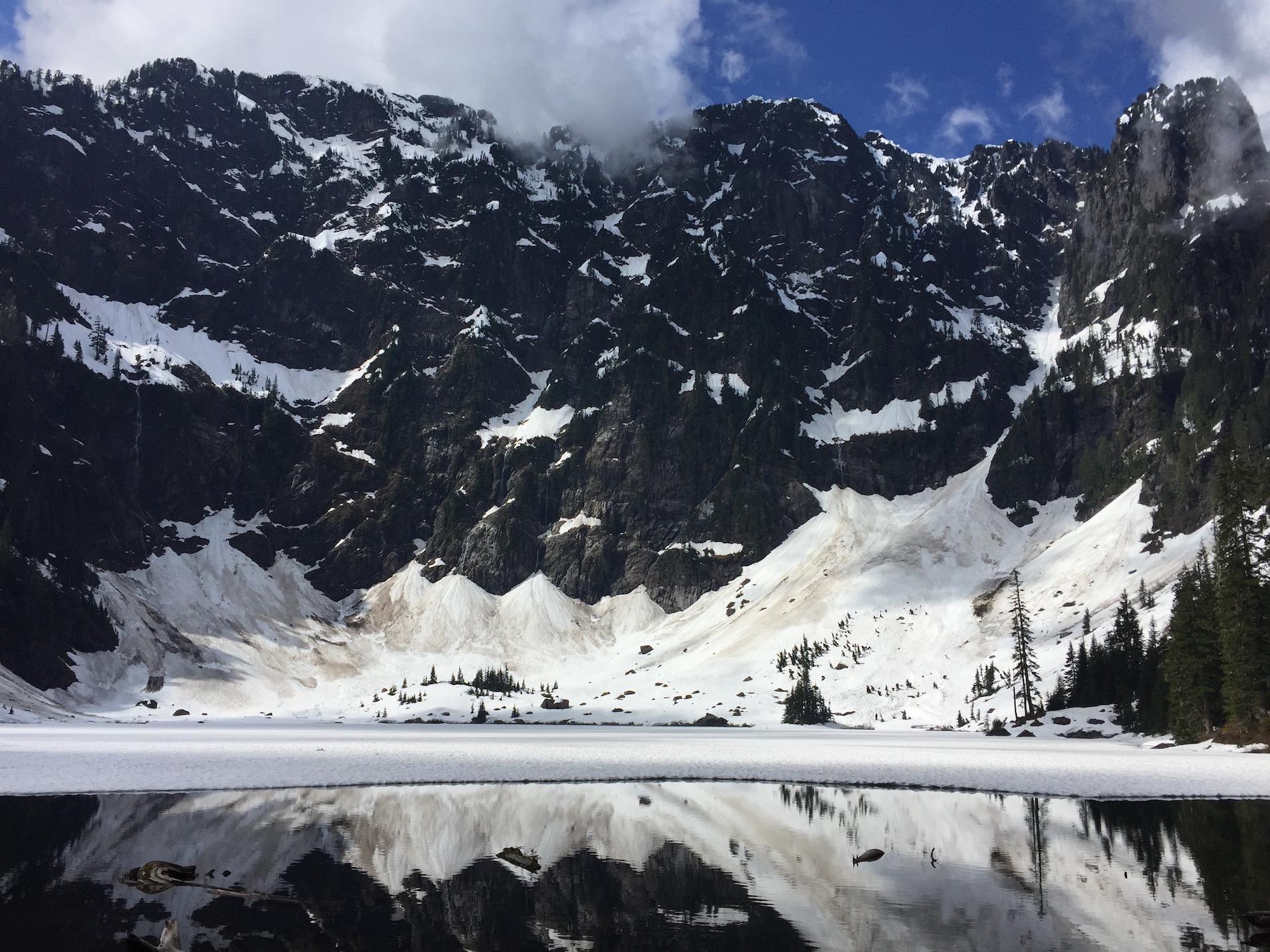

Distance: 5.4 mi RT
Elevation Gain: 1350 ft.
Location: North Cascades
Company: Greta + friends
Notes: For Greta’s 22nd birthday, we hiked Lake 22 (complete with Taylor Swift’s “22” on repeat). I wasn’t expecting to like this hike as much as I did. I mean I knew it would be great, but this was GREAT. Forewarning, we went during May and it turned into more snowshoeing than hiking as we were sliding on ice and trekking through snow at the top. Nonetheless, the glass reflection of the mountains on the lake make you want to do it 22 times more.
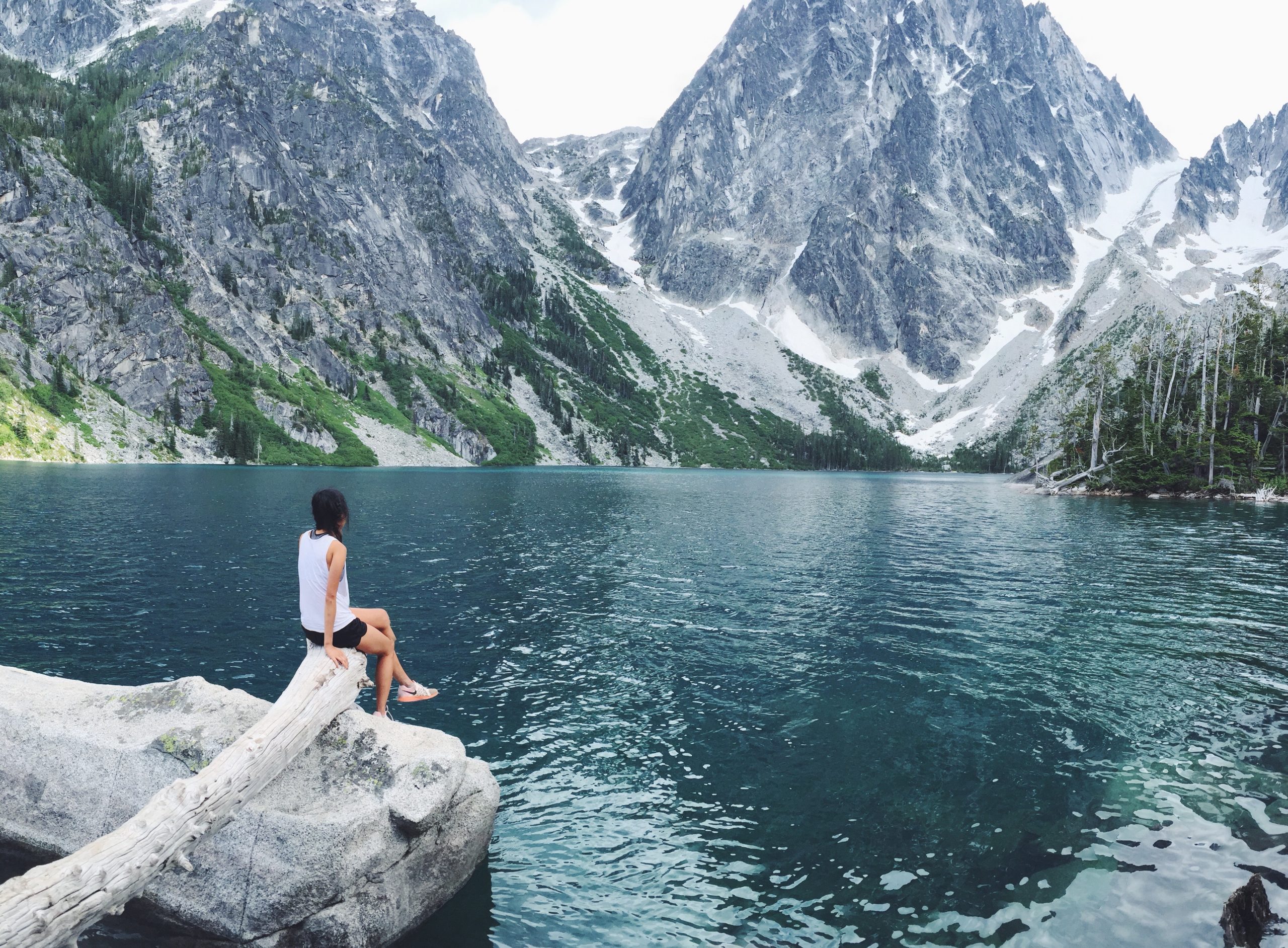
 Distance: 8.0 mi RT
Elevation Gain: 2280 ft.
Location: Central Cascades
Company: Derek
Notes: This is by far one of my favorite, if not favorite hikes. Though it started off with the wrong hike (to be featured later), it was beyond worth it to turn that last corner and step into a meeting between heaven and earth. Being in such close proximity of the fabled Enchantments, it only makes sense these views captivate one’s eyes and soul to the deepest parts. The last leg of the trip is pretty tough, but just when you think you’re about to give up, you are greeted by crystal turquoise waters set below grand spires and the overwhelming peace of nature. Bring lunch (you’ve earned it!) and plan to spend a couple hours enjoying the breathtaking views.
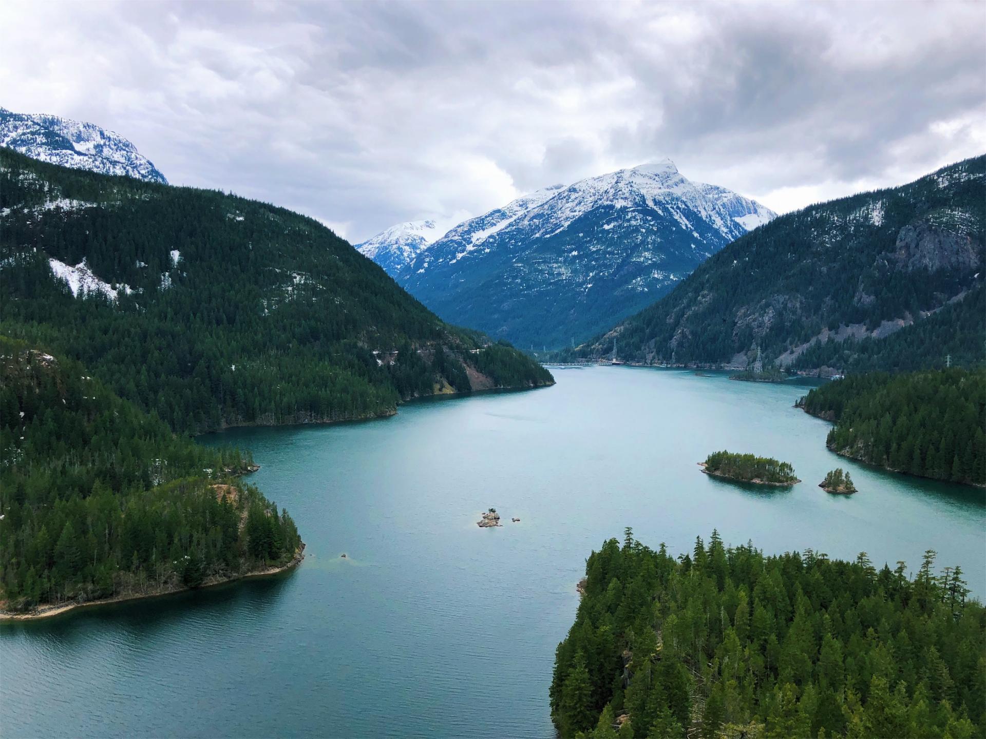

Distance: 7.6 mi RT
Elevation Gain: 1400 ft.
Location: North Cascades
Company: Sarah
Notes: If you look up pictures of Diablo Lake on the internet, you’ll see what looks like overly-filtered photos of an incredibly blue lake. Do not be mistaken, as these are what the actually lake looks like; UNREAL. The day we went the clouds shaded the sun a bit, but on a bright sunny day, the almost see-through sea green blue takes your breath away and it is encouraged to take at least 1000 pictures to prove it is real.
There are two parts to this lake, the hike and the lookout. After reading reviews, we came to the conclusion that the entire hike was not worth it, as the best views were about halfway into the hike. The trailhead is in an inconspicuous location, after crossing a dam and past some boat docks, but right before you enter the North Cascades National Park. When you come to a fork in the road, the trail heads right, not left, as we found ourselves lost the first 20 minutes by going left. Nonetheless, about an hour down the right trail, we found an open space to enjoy lunch and sit in the swaying silence. If you aren’t up for the hike and just want to admire the views from a far, there is an incredible panoramic vista point on the east end of the lake, accessible by following Highway 20.

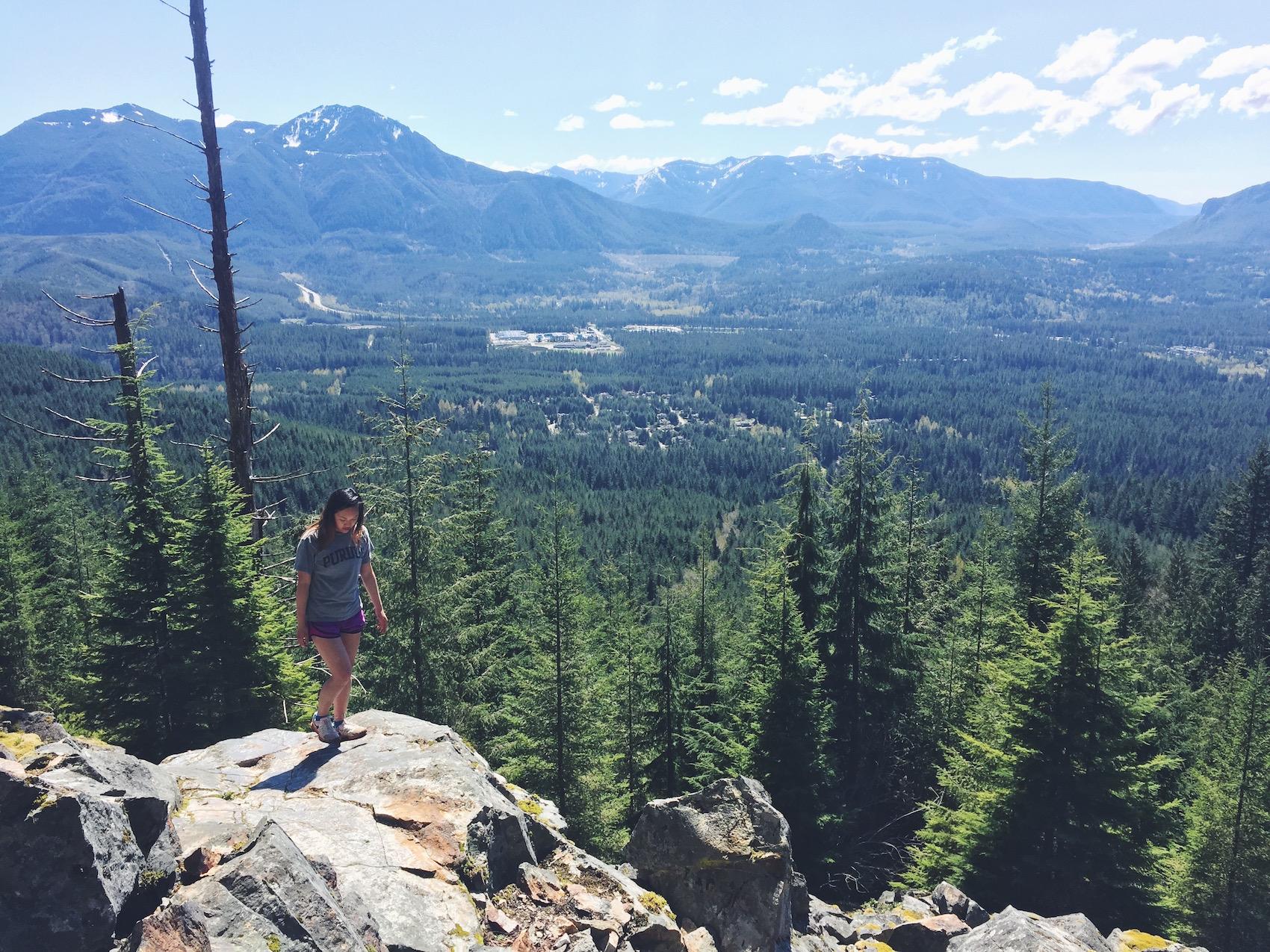
Distance: 6.6. mi RT
Elevation Gain: 1300 ft.
Location: Central Cascades
Company: Derek
Notes: This hike was not intentionally planned, but due to the misguidance of Derek’s directions, we ended up starting this hike thinking it was Colchuck Lake. About 2.8 miles into the hike with cranky attitudes, we turned around, realizing only after the fact that we stopped 0.2 miles short of the actual lakes. I don’t even know if this photo was from that hike. Plus, who names a six mile hike Eightmile Lake? Despite my shortcomings with this, the part that we did hike was pleasant and I’m sure the lakes are as lovely as others (not us of course) say they are.

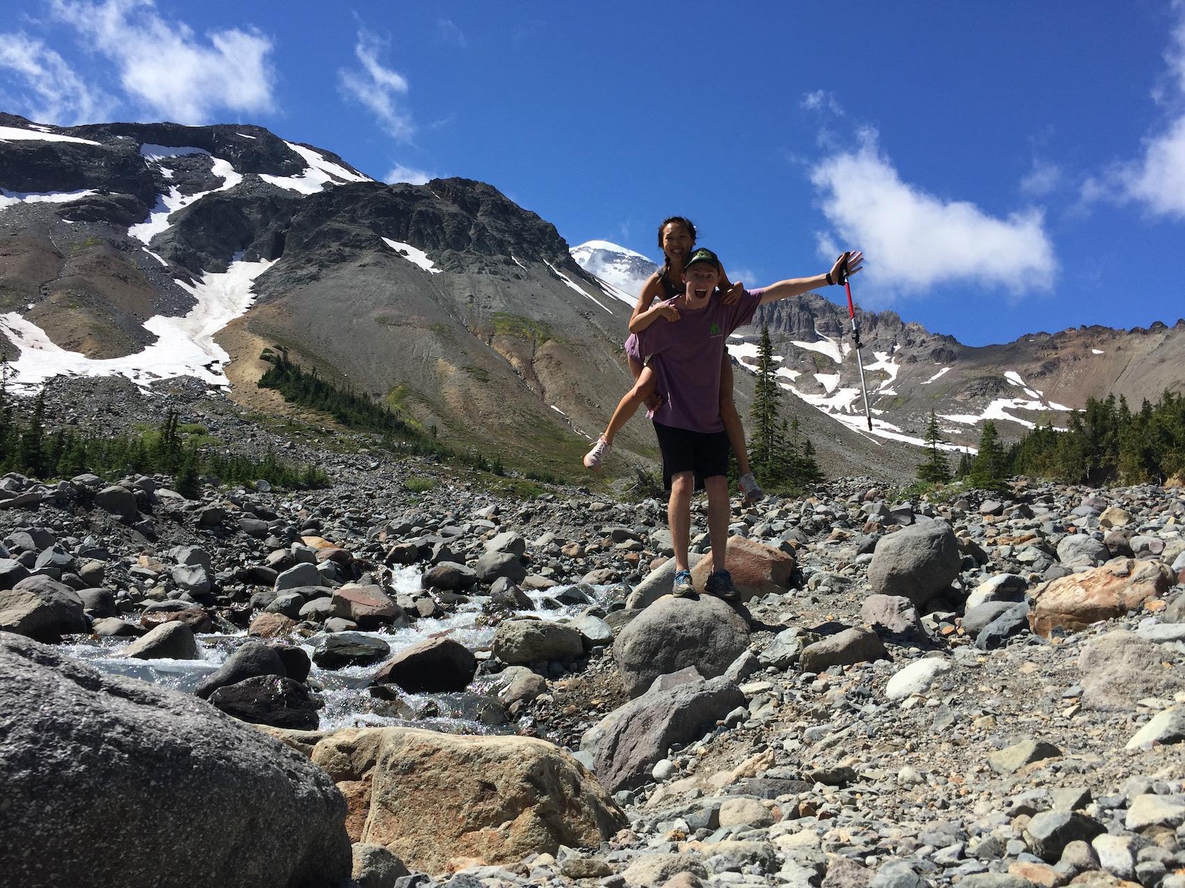
Distance: 6.5 mi RT
Elevation Gain: 1600 ft.
Location: Mt. Rainier- NE
Company: Derek
Notes: WOW WOW WOW. I seriously loved this hike. This was not your typical uphill hike, as a lot of was traversing over rock and dirt to, well, a big ol’ basin. Playing in fields of flowers and cold, clear glacier water made this hike the epitome of a summer hike in Washington. The wide open meadows to the little details of picking flowers and feeding chipmunks made this hike one I just felt complete happiness while hiking. If you want to enjoy this site for more than a day, be sure to check out the Glacier Basin wilderness camp to stay overnight or make a loop trip out of it.

Distance: 2.6 miles RT
Elevation Gain: 850 ft.
Location: Central Cascades
Company: Kiersten, Sarah, Tyler, Dakota
Notes: This hike was cold and wet and rainy, and I was tired and cranky, but good company and portable hot chocolate can save any day. If you want a short hike with great views, this is a good hike for all skill levels. Bring some extra snacks for when you reach the top of the lookout to feed birds right out of your hands. Feel free to explore the surrounding areas for some different scenery and discovery.

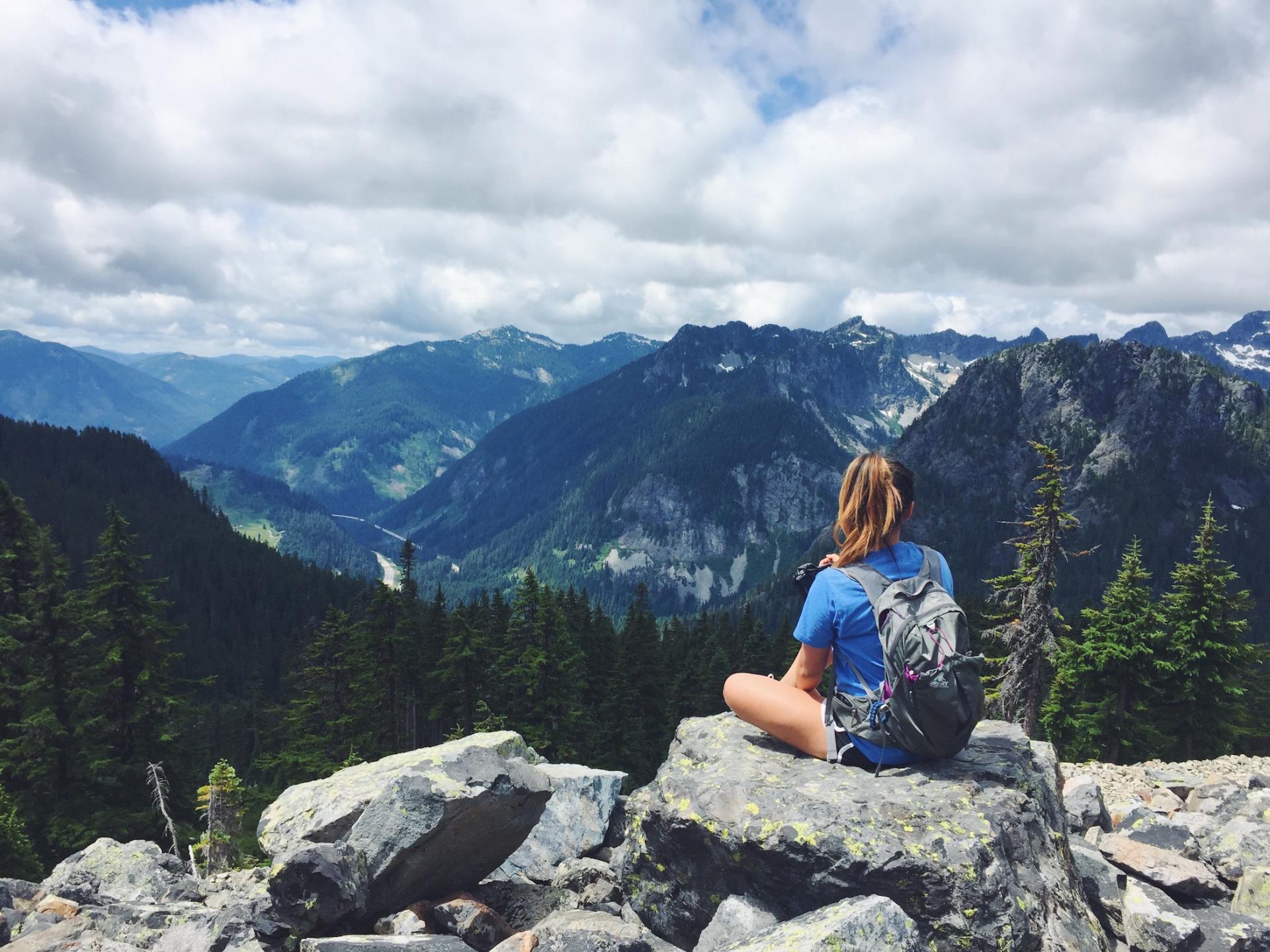
Distance: 12 mi RT
Elevation Gain: 2600 ft.
Location: Snoqualmie
Company: Mark + Sarah
Notes: This one was a long one that I thought I was prepared for, but I don’t think I actually was…but oh was it worth it. THE VIEWSSS. I actually think it was closer to 14.5 mi, if you include the walk from the road to the trailhead. Plan for an early start to a full day and don’t forget your water, as even the strongest and fittest will get a fair workout by hiking this. With a long hike like this, it’s definitely recommended to take your time stopping at different viewpoints and not rush to the top, as part of the beauty is in the journey. Beyond the stunning mountain views, you’ll know you’re at the katwalk, a narrow pathway with jaw-dropping views of the Alpine Lakes Wilderness and Gold Creek Valley on either side. If you want, you can continue an extra 1.25 miles past Kendall peak to a pair of lakes.

Distance: 4.7 mi RT
Elevation Gain: 1300 ft.
Location: Snoqualmie
Company: Michaelle, Kate, Kara, Trinity, Allie
Notes: I first hiked this with my core group from The INN at UPC, such a wonderful group of girls and great bonding experience on an easy and fun hike. Little brother to neighboring Mt. Si, Little Si proves most of it’s difficulty in just the last bit, making the rest of the hike popular among family and crows alike. I would suggest this hike along with Rattlesnake Ledge and Teneriffe Falls as easy half-day hikes that everyone will enjoy. While the hike itself doesn’t have the wow factor as others, the grand finale is a surprise as you are rewarded with phenomenal portraits of the valley and nearby Mt. Si and Mt. Washington.
 Distance: 8.5 mi RT
Elevation Gain: 2500 ft.
Location: Snoqualmie
Company: David
Notes: Melakwa is Chinook for “mosquito”. So yes, bring the bug spray, but don’t let that deter you from taking on this hike. It starts out wide and easy, then gets rocky and steep at the end, which leads you to a quite pleasant view. This lake plus mountain combination was a bit on the smaller scale in comparison to other mountaintops I have been to, but I wouldn’t disregard it as any less. The feeling of snugness and safety is a well-kept secret within this mysterious and magical space.

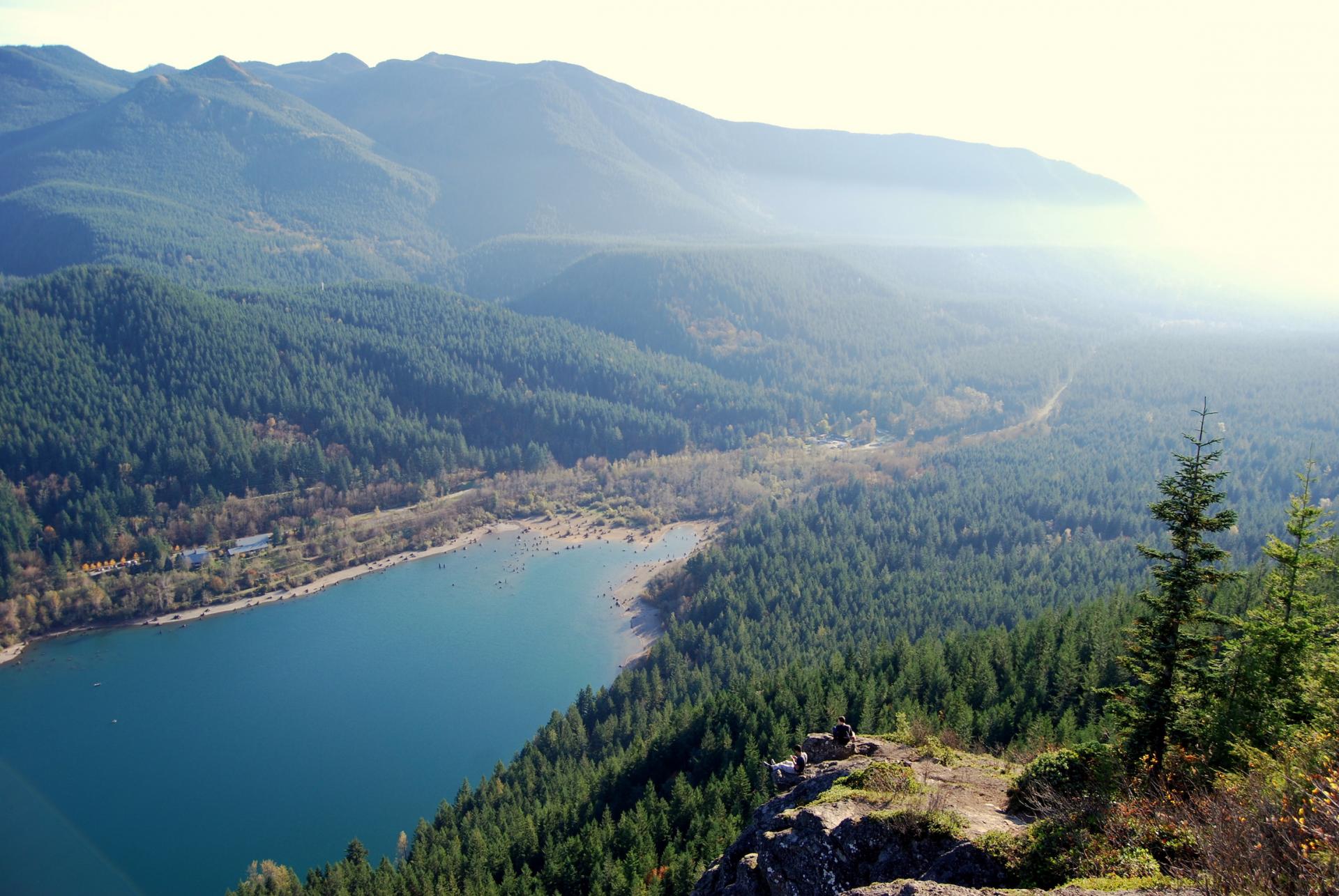
Distance: 4.0 mi RT
Elevation Gain: 1160 ft.
Location: Snoqualmie
Company: A lot of people
Notes: This is the classic Seattle hike. Moderately easy hike, well-maintained, very popular with people of all ages and ability. I’ve been three times and would say it is a good “bang-for-your-buck” hike. Sweeping views of the lake below, I love taking friends who have never been to Seattle on this one, though due to its popularity can easily become overcrowded. Nonetheless, it seems to be the hike with the longest hike-able season so that’s always a plus.
 Distance: ?
Location: Mt. Rainier
Company: Makayla
Notes: I don’t even know what this hike was called. A few years ago in July, my family, Makayla and I lodged in Paradise at the top of Mt. Rainier for a mountain getaway. Of course, the one day we decided to go hiking, it is pouring rain (dully noted, Seattle) so we stopped short. If you have the time, I am a huge advocate for staying a couple of days or even a long weekend to explore all the amazing hikes Mt. Rainier has to offer.
 Distance: 8.2 mi RT
Elevation Gain: 2000 ft.
Location: Central Cascades
Company: Bekah, Lauren, Jason, Kirk, Andi, Tate, Spencer
Notes: The reason you are seeing a picture of us standing on a big flat rock is because that is the only thing we could see when we finally made it up this hike huffing and puffing. From what pictures say about Lake Serene, it seems to be a beautiful expanse of aqua blue covering the base of ascending, snow-tipped peaks. As of now, I cannot say I have seen that same lake, or any lake at all, as my back-to-school hike mid-October with eager friends ended up in an opaque blanket of fog. Halfway up, you can take a side detour to see Bridal Veil Falls, something I recommend visiting on the way up while you still have energy, in case the same fate awaits you. Pack snacks, be prepared for the adventure, and remember it’s about the journey and not the destination (unless the destination is super rad then yes, it’s about the destination.)
IMPORTANT: As of 3/21/18, this trail is closed until 7/1/18.

Distance: 5.4 RT
Elevation Gain: 1585 ft.
Location: Snoqualmie
Company: Chelsea
Notes: This was a sweet hike perfect for a sunny day. A neighbor to Little Si, it’s got the ease of Little Si with less tourists and equally stunning and simple views. Not too far from Seattle, it’s the perfect hike for the whole family, or best of friends. Go in the spring so that the falls are full and flowing.
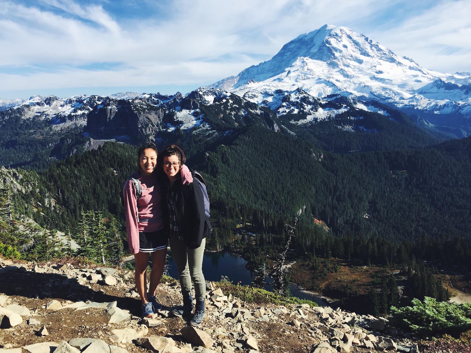

Distance: 7.5 RT
Elevation Gain: 1100 ft.
Location: Mount Rainier- NW
Company: Jackie
Notes: It was mostly a miracle by God that the weather at the beginning of October made this hike absolutely magical. I’ve wanted to do this hike for so long and as you should know, one of the first rules is hiking is go with good company, so early in Jackie and I’s forever friendship we headed south to what I would say is one of my favorite hikes in terms of views. The first 0.5 mile and we knew it was off to a great start as we passed the crystal blue Mowich Lake whose calmness and vibrant color easily reeled us in for a return. All you need to know is that Tolmie Peak has the most EPIC views of Mt. Rainier, it doesn’t even look real. There is also a fire lookout at the top, I felt so close to Mt. Rainier that I could have touched it!
To-Do Hikes
Mailbox Peak
Mt. Pilchuck
Ice Caves
Olympics
Blanca Lake
Skyline Trail
Summit Lake
If you have any other recommendations, let me know!


")

LOVE LOVE LOVE THIS. THANK YOU ????